You’ve made it this far? Congratulations. Most of the tourists who visit Iceland tend to either turn around and head back to Reykjavík after checking out the Golden Circle or after travelling as far as the south coast to see the world-renowned Black Beach and Glacier Lagoon.
I’m guessing that if you’re here looking for information about Hengifoss, you’ve probably decided to spend a bit more time in Iceland, completing what has become known as the “Diamond Circle.”
If so, you’re made the right decision - Iceland deserves a lot more time than the average tourist is able to invest and if you complete the Diamond Circle, you’ll be rewarded for your decision with amazing waterfalls, the beautiful Lake Myvatn, Hverfjall Mountain, hot spring resorts and much, much more.
Once you’ve made it past the Jokulsarlon Glacier Lagoon, you’ll have officially made it further than a large percentage of travellers. Your next stop along the road is likely the be southern-most city of Hofn to rest and stock up on supplies for your drive along the western coast of the country.
For most travellers, the first major destination along the eastern coast will be the waterfall known as Hengifoss - or the “Hanging Falls”, which is one of the prettiest waterfalls in the country and is also situated on one of Iceland’s most popular hiking trails.
Hengifoss
Regarded as one of the highest waterfalls in the country, Hengifoss is also one of the most beautiful thanks to the very unique nature of the environment that surrounds it.
The water, which originates from a plateau above descends 128 meters into a beautiful gorge that flows further down the mountain and eventually meets with Lake Lagarfljot.
What makes Hengifoss stand out though is not its height - it is considered either the second or third highest waterfall in the country - nor the amount of water that flows from the top. It’s uniqueness is thanks to the spectacularly coloured layers of strata in the gorge which brilliantly displays the age of this waterfall and of Iceland itself.
The different layers, some of which date back to the Tertiary Period display the various stages of Iceland’s geological development through the shifting of tectonic plates and volcanic eruptions. - all of which have molded the island into the ever-changing landmass that it is today.
Most notable are the eye-catching layers of red clay which are fossilized trunks of coniferous trees which are between two to sixty million years old.
The different layers of strata are beautifully lined up making the red layers of clay and the black layers of basalt look like naturally designed stripes with a waterfall conveniently in the centre.
Although the waterfall is among the highest in the country, it certainly doesn’t seem like it when you’re standing nearby as the flow of water isn’t comparable to what you’ve likely already seen at Gullfoss.
That shouldn’t matter though - You should be visiting this one more for the spectacular display of our planet’s geological history with the added bonus of a giant waterfall.
Another reason why Hengifoss stands out from the other waterfalls that you will have visited on your trip is that it isn’t located directly next to a road or the highway. In fact, if you plan on visiting this waterfall you should know that you’re going to have to be prepared for a bit of a hike.
The hike, which is roughly a two hour round trip is a beautiful one with great views of Lake Lagarfljot flanked by snow-capped mountains to your rear with mountains and Hengifoss easily visible all the way along the trail.
It suppose the hike could be considered a bit steep in some spots, so if you plan on visiting, be prepared for a bit of a workout. Never fear though, even though the hike takes around two hours, the trail is well-maintained by local authorities and the path is easy to navigate.
I should probably also mention that even though most people are hiking to see Hengifoss, you’re also going to walk past the beautiful Litlanesfoss waterfall as well!
Two waterfalls for the price of one! (Admission is free by the way).
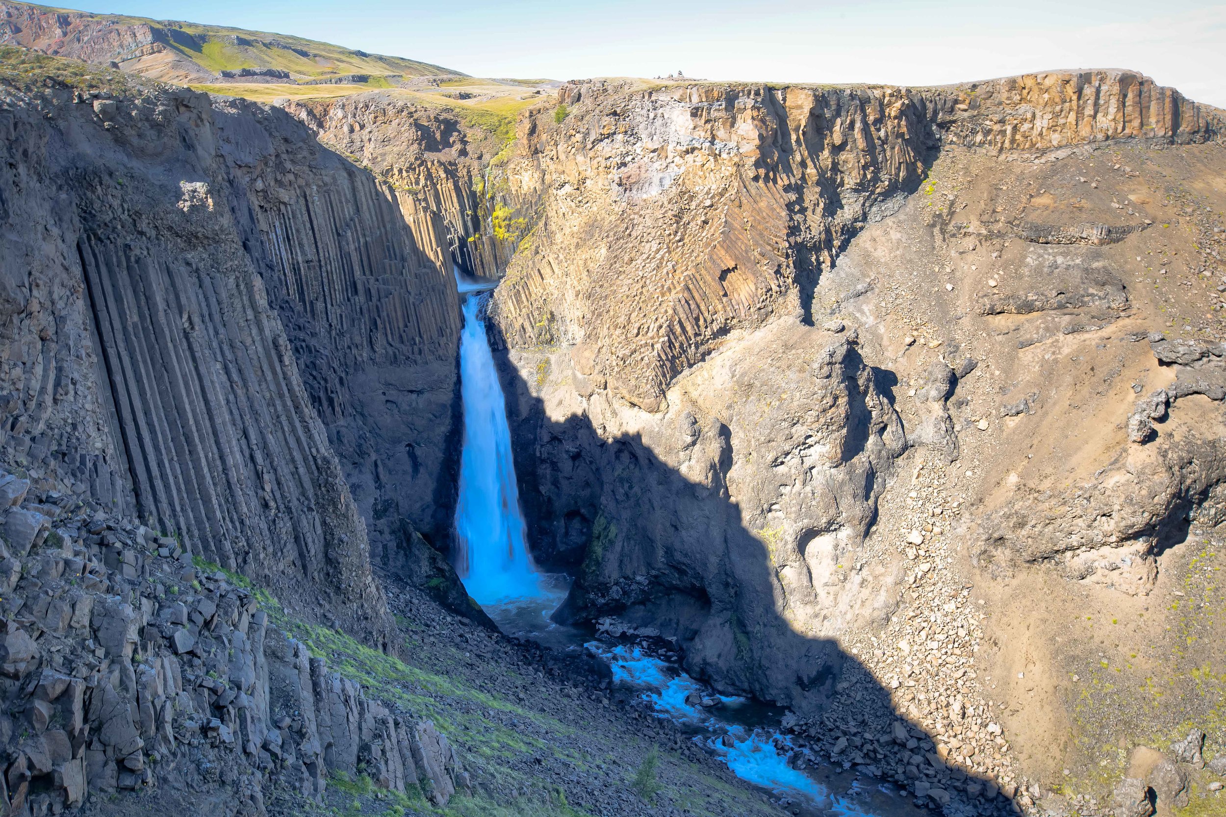
Litlanesfoss Waterfall, like the larger waterfall upstream is also quite notable thanks to its special geological features. Unfortunately it tends to be overshadowed by the much larger Hengifoss.
The waterfall is considerably smaller at around only 40 meters in height, but is known for its beautiful columns of basalt rock that resemble a naturally formed staircase - a larger version of what you probably saw at the Black Sand Beach earlier in your travels.
The reason why this pretty waterfall is so easily overshadowed is because it is generally just a short stop along the trail. It is situated deep in a gorge and you can’t get close enough to it like you can with Hengifoss.
After you finish checking out Litlanesfoss, you’ll round a slope on the mountain and Hengifoss will start to appear in the distance. Once you get close enough you will notice signs that warn visitors not to get too close.
Some people obviously continue to walk further up the river stream to get as close to the falls as they can.
It is important to remember though that you are pretty much in the middle of no where and if you have an accident, it is going to take a bit of time before someone comes to rescue you. Don’t put yourself in unnecessary danger.
In truth, I hiked up a bit further than was permitted and set up my tripod in the middle of the river to take photos of the waterfall. I didn’t really walk that far though and I tried to put myself in a spot where I wouldn’t be ruining other people’s photos.
I have seen claims that there is a cave behind the waterfall that you can walk into - if you want to get in the cave though you’re going to have to do a bit of dangerous river tracing while climbing over massive rocks and you’re going to have to be prepared to get wet.
Most tourists don’t come prepared for this kind of adventure - and I don’t recommend you even attempt it if you don’t have the proper gear and a tour guide that knows the area.
Safety is the most important consideration when you’re travelling, so don’t do anything too dangerous and remember that Iceland is an incredibly expensive place to traveil. I doubt you’ll want to break the bank on an emergency helicopter ride back to a Reykjavik hospital.
Getting There
Ok, so I’m going to really recommend you learn from my mistake here. There are two different routes that will bring you to Hengifoss.
Google Maps will present you with two different routes to get to Hengifoss - One of the routes will take you along the coastal highway to the town of Egilsstadir and then you’ll backtrack along the massive Lake Lagarfljot before arriving at the parking lot for the hike.
It will also present you with a route that will take you in-land through the mountains.
DO NOT TAKE THE ROUTE THROUGH THE MOUNTAINS!
The road is completely washed out and is in a state of extreme disrepair. It will probably also cause a bit of damage to your rental car. Learn from me. I promise, you’ll appreciate the advice.
Follow Route One from Hofn all the way to Egilsstadir and then transfer to Route 95 and continue south.
You’ll arrive at the parking lot about half an hour later and your car will still be in pretty good shape!
Hengifoss is one of the highest waterfalls in Iceland but as I’ve mentioned above, its unique geological features somewhat overshadow the height of the falls. If you are travelling through the eastern-coast of Iceland and this waterfall is not on your itinerary you are definitely missing out. Don’t let a bit of exercise scare you away from seeing one of the prettiest waterfalls in a country that is…. full of waterfalls.


